
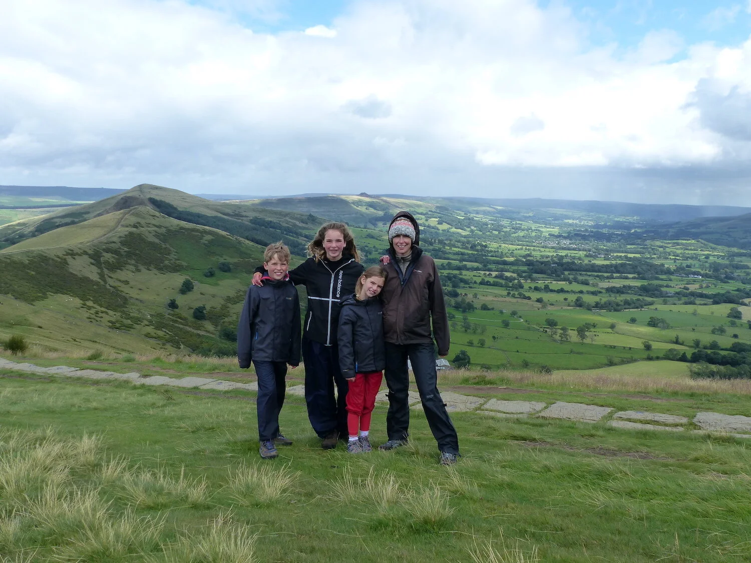

A HIKE TO MAM TOR AND BEYOND
The harmonious village of CASTLETON enjoys a superb location in the centre of the Peak District, surrounded by caverns and castle ruins and nestled in the lee of a long ridge that marks the shift from the White Peak’s limestone dales to the brooding moorland of the Dark Peak. You’ll be striding out across that rim today, enjoying the fabulous views on offer throughout the GREAT RIDGE WALK. The 7-mile circuit from Castleton takes around 3 hours and 30 minutes, depending on the ages of your children and how often you stop to admire the scenery. Take a picnic and make a day of it.
Starting at the National Park Visitor Centre in Castleton, turn left onto the main road, first right onto Castle Street and then right again at the end of the road, following the lane as it winds around to the left, over the bridge and then straight on up Goosehill (signed as a cul-de-sac), where it narrows into a footpath that leads up out of the village and across Long Cliff (National Trust). The path carries on up towards the hills before veering right and down to Speedwell Cavern. Cross over the main road here and follow the footpath up to Treak Cliff Cavern (you’ll be visiting the cave itself tomorrow), around the hill past Blue John Cavern and then up (to the left) to Winnats Head Farm. Turn right, along the farm’s wall, and continue through the gate and over the field beyond. Cross the main road and follow the path over Windy Knoll (National Trust) and, after crossing the main road again, up the hill ahead. At the top (about 2.5 miles from Castleton), the path joins up with a staircase of slabs – the start of the Great Ridge Walk proper – that leads to MAM TOR (“Mother Hill”). The iconic peak enjoys sensational views across the Edale Valley towards Kinder Scout to the north and back down over Castleton and the Hope Valley to the south; it’s often blowing a gust up here, which adds to the adventure. Strike out along the ridge that you can see doglegging into the distance ahead of you; the flagstone path leads for a mile round, down and then rockily up to exposed HOLLINS CROSS. Press on along the ridge and clamber up another hill, BACK TOR, which drops off steeply one side to a little wood – so take care on this bit. Beyond Back Tor, a steady incline leads to the final summit of LOSE HILL (about a mile all told from Hollins Cross) and the reward of far-reaching views over distant dales and a patchwork of fields, neatly divided by drystone walls and dotted with the little white flecks of grazing sheep. Follow the path on from here down towards the Hope Valley. Shortly after you go through a gate, the path forks; stay right, go over a stile and turn left to follow the path down towards a section of trees (you should be on the right-hand side of the wire fence by now). Bear right when the path forks again on the other side of the trees, head through the gate and then over the stile on the right-hand side of the field ahead. Go straight across the next three fields, then turn immediately left (downhill), walking past a farm on your right before heading into a thicket of trees and crossing a small wooden bridge. After climbing the steps on the other side, stick to the left-hand side of the next two fields (there’s another farm on your left here) and you’ll emerge on the lane behind YHA Castleton Losehill Hall. Turn right, then turn left at the end of the lane to bring you back to the main road, on the eastern edge of Castleton. Turn right, cross over and follow the road into the village. This last stretch down from Lose Hill is just over 2 miles. By now, you’ll be about ready for some refreshments in one of the pubs on the way back to the National Park Visitor Centre – you’ve earned it!
TOP TIP For a SHORTER WALK along the ridge and back, you can drive up to Mam Tor, 2 miles west of Castleton, and park at the Mam Tor National Trust Car Park [£3.50 for up to 4 hours parking, £5 for over 4 hours; free for National Trust members], which is where the “staircase of slabs” that leads up to the tor starts from. You could walk to Hollins Cross and back (2.5 miles return trip) or all the way along the ridge to Lose Hill and back (4.5 miles in total). The drive there from Castleton winds up through the spectacular WINNAT’S PASS, a collapsed limestone cavern that is one of the most photographed roads in UK.


THE LIJOMA LOWDOWN

OUR FAVOURITE PLACES TO STAY IN THE PEAK DISTRICT
From family-friendly inns to country cottages – our pick of the most memorable places to stay in The Peak District

PEAK DISTRICT ESSENTIALS
Pre-trip practicalities, including getting there, getting around and what to take with you
MORE AMAZING TRIPS

THE SCOTTISH HIGHLANDS
An eight-day journey through Scotland’s wildest region

CORNWALL
A wonderful week on Cornwall’s coasts, from Charlestown to Tintagel